Powerful Hurricane Mario Strengthens Off Mexico's Coasts, Poses Threat
 Layla Al Mansoori
Tropical Storm Mario Regains Strength in Pacific Waters, Poses No Immediate Coastal Threat
Tropical Storm Mario has regained its tropical storm status off Mexico's Pacific coast after briefly weakening to a tropical depression, marking another episode of rapid intensification and weakening that has become increasingly common in Pacific storm systems. While no coastal watches or warnings are currently in effect, the storm's erratic behavior highlights the unpredictable nature of late-season tropical activity in the Eastern Pacific basin.
Storm's Volatile Development Pattern
Mario first achieved tropical storm strength on Friday before quickly deteriorating to tropical depression status within hours. By Sunday morning, the system had reorganized and regained tropical storm classification, demonstrating the rapid fluctuations that characterize many Pacific storms.
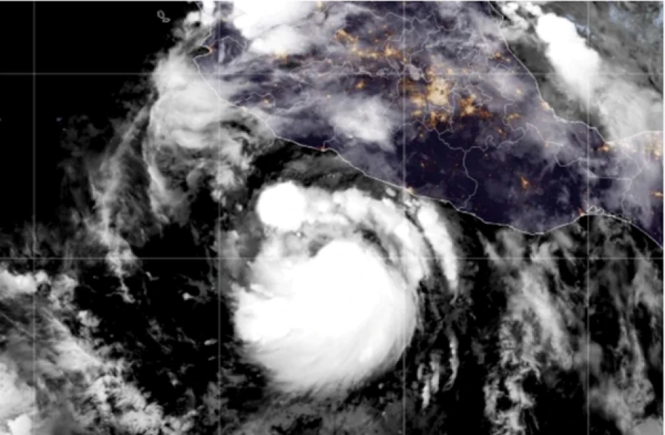
As of Sunday afternoon, Mario was positioned approximately 35 kilometers east-northeast of Socorro Island and roughly 450 kilometers south of Baja California's southern tip. The storm maintained maximum sustained winds of 75 kilometers per hour while moving west-northwest at 11 kilometers per hour.
Forecast and Regional Implications
Expected Strengthening Before Decline
The National Hurricane Center in Miami projects that Mario will continue gaining strength through Monday before beginning to weaken Monday evening and into Tuesday. This pattern suggests the storm will likely remain over open waters, reducing immediate threats to populated coastal areas.
Pacific Storm Season Context
Mario's development occurs during a period when Eastern Pacific tropical activity typically begins to wane. The storm's location near Socorro Island, part of Mexico's Revillagigedo Archipelago, places it in waters that often serve as a breeding ground for tropical systems that either strengthen into major hurricanes or dissipate rapidly depending on atmospheric conditions.
The absence of coastal warnings reflects both the storm's current trajectory away from major population centers and Mexico's improved early warning systems, which have significantly enhanced coastal preparedness along both Pacific and Atlantic coastlines in recent years.
Broader Weather Pattern Significance
While Mario currently poses minimal direct threat, its behavior exemplifies the increasing volatility seen in tropical storm development patterns. Climate scientists have noted that rapid intensification and weakening cycles are becoming more common across global tropical basins, making storm prediction more challenging for meteorologists and emergency planners.
The storm's proximity to Baja California also serves as a reminder of the region's vulnerability to tropical systems, particularly during late summer and early fall when sea surface temperatures remain elevated enough to sustain storm development.


