Powerful Hurricane Irene Poses Threat to U.S. East Coast
 Layla Al Mansoori
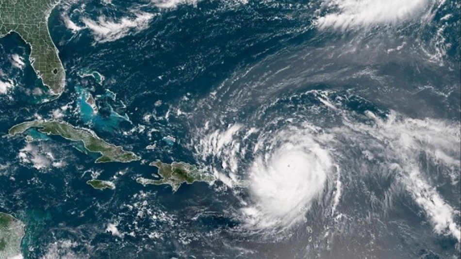
Hurricane Erin Triggers Mass Evacuations as Deadly Storm Surge Threatens U.S. East Coast
Hurricane Erin is advancing toward the U.S. East Coast, generating life-threatening surf conditions that have already prompted dozens of beach rescues. While the storm's center is expected to remain offshore, its outer bands threaten to bring destructive tropical winds, massive waves, and deadly rip currents to millions of coastal residents from Florida to New England.
Immediate Threat Escalates Along Barrier Islands
The most severe danger zone centers on North Carolina's Outer Banks, where mandatory evacuation orders are now in effect. These narrow barrier islands, stretching roughly 200 miles along the coast, are particularly vulnerable to storm surge and have historically borne the brunt of Atlantic hurricanes tracking northward.
Weather experts maintain confidence that Erin's core will stay offshore, but emphasize that even a slight westward shift could dramatically increase the threat level. The storm's outer circulation alone is capable of generating tropical storm-force winds extending hundreds of miles from the center, creating hazardous conditions well beyond the hurricane's eye.
Rescue Operations Intensify Before Peak Impact
Emergency responders have already conducted numerous water rescues as dangerous surf conditions arrived ahead of the storm's closest approach. The National Weather Service has issued rip current warnings spanning the entire Eastern Seaboard, with wave heights expected to reach 15-20 feet in the most exposed areas.
Historical Context Shapes Response Strategy
The evacuation protocols reflect lessons learned from previous storms that remained offshore yet still caused significant damage. Hurricane Sandy in 2012 demonstrated how storms tracking parallel to the coast can generate prolonged periods of destructive conditions, even without making direct landfall.
North Carolina's barrier islands have experienced this phenomenon repeatedly, with storms like Hurricane Dorian in 2019 causing extensive flooding and wind damage while remaining technically offshore for much of their passage.
Economic and Infrastructure Implications
The storm's trajectory poses significant risks to critical infrastructure along one of America's most densely populated coastlines. Major ports from Norfolk to Boston are implementing hurricane protocols, potentially disrupting supply chains already strained by global economic pressures.
The tourism industry faces immediate losses as beach communities enter peak summer season. The Outer Banks alone generate hundreds of millions in annual tourism revenue, with evacuation orders effectively shutting down economic activity during what should be one of the busiest periods of the year.
Climate Pattern Analysis
Erin's behavior fits a concerning trend of storms maintaining intensity longer and tracking closer to populated coastlines. Warmer ocean temperatures provide more energy for storm systems, while changing atmospheric patterns can influence steering currents that determine a hurricane's path.
This storm represents the type of near-miss scenario that emergency planners increasingly prepare for – events that don't require the full catastrophic response of a direct hit, but still demand massive coordination and can cause substantial damage through prolonged exposure to tropical conditions.
The next 48-72 hours will determine whether Erin maintains its offshore track or edges closer to land, potentially transforming a manageable situation into a major disaster for millions of East Coast residents.


