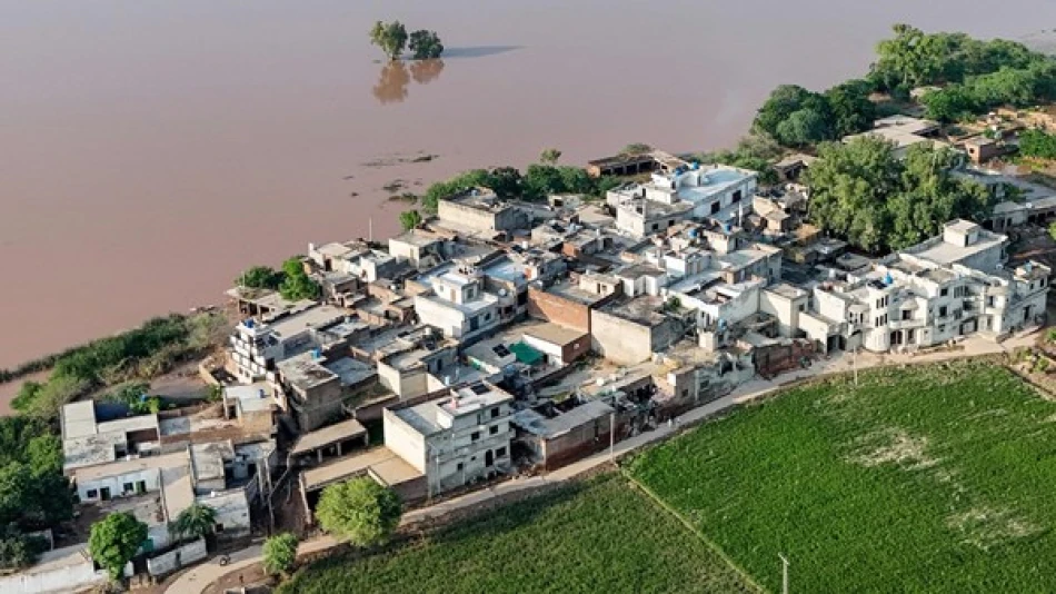
Floods Threaten Two Pakistani Cities as Dam Levels Rise
Pakistan Faces Dam Crisis as Monsoon Floods Threaten 2.8 Million Lives
Pakistan's eastern Punjab province is on the brink of a humanitarian disaster as the Qadarabad irrigation dam on the Chenab River reaches critical capacity, threatening to unleash catastrophic flooding across two major cities. The crisis underscores the deadly intersection of climate change, aging infrastructure, and cross-border water management challenges that plague South Asia's monsoon season.
Critical Infrastructure Under Extreme Pressure
The concrete barrier at Qadarabad, which regulates water flow into Pakistan's vital irrigation network, has exceeded its capacity due to torrential monsoon rains. Officials from Pakistan's National Disaster Management Authority describe the situation as a full-blown crisis, with water levels beginning to recede under expert supervision but remaining dangerously high.
The cities of Chiniot and Hafizabad, home to approximately 2.8 million people, face the immediate threat of being swept away if the dam fails. This population density makes the potential disaster comparable to major urban flooding events that have devastated other South Asian cities in recent years.
Monsoon Season Turns Deadly Across Region
Since late June, Pakistan and India have endured one of their most severe monsoon seasons in recent memory. The seasonal rains, typically crucial for agriculture and water security, have instead brought widespread destruction. Hundreds have died across both nations as rivers overflow, dams reach capacity, and flash floods tear through communities.
Pakistani authorities have already evacuated over 210,000 villagers from areas near the Ravi, Sutlej, and Chenab rivers—all of which originate in India before flowing into Pakistan. This massive displacement highlights the scale of the crisis and the strain on emergency response systems.
Cross-Border Water Politics Complicate Crisis Response
The disaster has exposed the complex dynamics of transboundary water management between India and Pakistan. India has issued its third flood warning since Sunday, this time for the Sutlej River, following two previous alerts for water heading toward Pakistan via the Ravi River.
These cross-border water flows reflect the shared river systems that connect the two nations, but also the challenges of coordinating flood management across political boundaries. The Indus Waters Treaty, signed in 1960, governs water sharing between the countries but doesn't fully address modern climate-induced extreme weather events.
Infrastructure Vulnerability Exposed
The Qadarabad dam crisis reveals broader infrastructure vulnerabilities across Pakistan's water management system. Many of the country's irrigation and flood control structures were built decades ago and struggle to handle increasingly intense weather patterns driven by climate change.
Pakistan's Punjab province, often called the country's breadbasket, depends heavily on these irrigation networks fed by the Indus River system. The potential failure of key infrastructure like the Qadarabad barrier could have devastating consequences not just for immediate flood victims, but for the region's agricultural productivity and food security.
Climate Change Amplifies Traditional Risks
This crisis exemplifies how climate change is intensifying traditional monsoon patterns across South Asia. While seasonal rains have always brought both life-giving water and flood risks to the region, the increasing frequency and intensity of extreme weather events are overwhelming existing infrastructure and emergency response capabilities.
The 2.8 million people at risk in Chiniot and Hafizabad represent just a fraction of the hundreds of millions across South Asia who face similar vulnerabilities as climate change makes extreme weather more common and severe. The current crisis may serve as a preview of future challenges unless significant investments are made in climate-resilient infrastructure and cross-border cooperation mechanisms.
Most Viewed News

 Layla Al Mansoori


