Devastating Earthquake Rocks Papua New Guinea, Causing Widespread Damage and Casualties
 Layla Al Mansoori
Papua New Guinea Hit by Second Major Earthquake in Four Days as Pacific Ring of Fire Activity Intensifies
Papua New Guinea experienced its second significant earthquake this week, with a 5.9-magnitude tremor striking the region on Thursday, just days after a 5.8-magnitude quake rattled the Pacific island nation. The latest seismic activity underscores the country's position as one of the world's most earthquake-prone regions and highlights growing concerns about increased tectonic instability along the Pacific Ring of Fire.
Latest Seismic Event Details
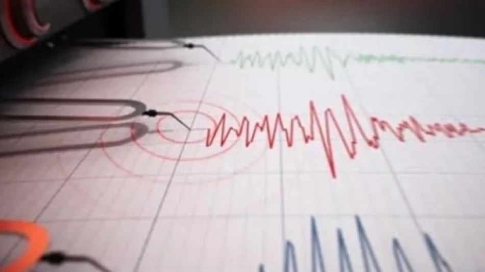
According to the German Research Centre for Geosciences, Thursday's earthquake registered 5.9 on the Richter scale and occurred at a depth of 110 kilometers beneath New Guinea. The relatively deep epicenter likely reduced surface damage, though the tremor's strength places it in the category of moderate earthquakes capable of causing structural damage in populated areas.
The timing of this latest quake is particularly noteworthy, coming just four days after Monday's 5.8-magnitude earthquake struck the same general region. This clustering of seismic events suggests ongoing tectonic stress release in the area.
Papua New Guinea's Seismic Vulnerability
Ring of Fire Location Creates Perfect Storm
Papua New Guinea's location within the Pacific Ring of Fire makes it a natural hotspot for seismic activity. This horseshoe-shaped zone around the Pacific Ocean accounts for approximately 90% of the world's earthquakes and 75% of active volcanoes. The country sits at the intersection of multiple tectonic plates, including the Pacific, Australian, and smaller regional plates, creating a complex web of fault lines.
The nation experiences hundreds of earthquakes annually, with most registering below 4.0 on the Richter scale. However, the recent sequence of moderate-strength quakes raises questions about whether the region is entering a more active seismic period.
Historical Context and Patterns
Papua New Guinea has endured several devastating earthquakes in recent decades. The 1998 tsunami-generating earthquake near Aitape killed over 2,000 people, while a 7.5-magnitude quake in 2018 caused widespread damage and disrupted the country's crucial liquefied natural gas operations for months.
Seismologists have noted that earthquake clustering is common in tectonically active regions like Papua New Guinea. The current sequence mirrors patterns observed before larger seismic events, though predicting earthquake timing remains scientifically impossible.
Economic and Infrastructure Implications
Resource Sector Vulnerabilities
Papua New Guinea's economy heavily depends on natural resource extraction, including gold, copper, and natural gas. The country hosts several major mining operations and the PNG LNG project, which represents one of the largest industrial investments in the Pacific region. Repeated seismic activity poses ongoing risks to these critical infrastructure assets.
The 2018 earthquake's impact on gas production demonstrated how seismic events can ripple through global energy markets. ExxonMobil's PNG LNG facility was forced offline for months, affecting regional energy supplies and highlighting the vulnerability of resource-dependent economies to natural disasters.
Building Standards and Preparedness Challenges
Unlike earthquake-prone developed nations such as Japan or New Zealand, Papua New Guinea faces significant challenges in implementing and enforcing modern seismic building codes. Rural communities, which comprise the majority of the population, often live in structures poorly equipped to withstand major earthquakes.
The country's mountainous terrain and limited transportation infrastructure also complicate disaster response efforts, making earthquake preparedness and early warning systems crucial for minimizing casualties.
Regional Seismic Trends and Scientific Monitoring
The recent Papua New Guinea earthquakes occur amid heightened seismic activity across the broader Pacific Ring of Fire region. Similar increases in earthquake frequency have been observed in Indonesia, the Philippines, and parts of the western United States over the past year.
International seismic monitoring networks, including the German Research Centre for Geosciences and the U.S. Geological Survey, continue tracking these patterns to better understand regional tectonic processes. Advanced earthquake detection systems now provide near real-time data, enabling faster tsunami warnings and emergency responses.
The clustering of moderate earthquakes in Papua New Guinea serves as a reminder of the ongoing geological forces shaping the Pacific region and the critical importance of disaster preparedness in one of the world's most seismically active zones.


